|
|
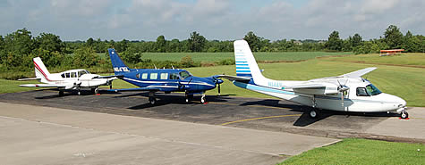
One of the major services Aerial Viewpoint provides is high precision
aerial survey data acquisition. For this service, Aerial Viewpoint
owns and operates three specially modified, FAA certified aerial
survey aircraft. An aerial survey aircraft is generally defined
as a civilian aircraft that has undergone substantial modifications
to the airframe structure to allow for the installation of aerial
survey cameras. These modified survey aircraft are then placed
into service to provide a platform for aerial surveying and mapping.
All three of Aerial Viewpoint’s aircraft have received these
necessary modifications, along with the installation of the aerial
survey cameras. All modifications were accomplished according to
the strict guidelines set forth by the FAA and then were fully
approved to obtain aerial survey imagery as required for our client’s
special projects.
|